Ajah flood alert today: routes, school-run timing and verified local updates
What the Lagos flood alerts mean for Ajah and Badore, how to time the school run around heavy rain, and how residents can verify street-level updates before sharing them.
What the September 2026 alert actually said
On 21 September 2026, the Lagos State Government directed residents in low-lying and flood-prone communities to relocate temporarily to higher ground. The directive followed a seven-day national flood advisory from the Nigeria Hydrological Services Agency covering Lagos and 14 other states between 19 and 25 September.
The Commissioner for the Environment and Water Resources, Tokunbo Wahab, named Eti-Osa, Lagos Island, Oke-Ira Nla in Ajah, Kirikiri Sea Port, Ilaje Waterfront Jetty and Jetty Terminal B among the vulnerable locations. He said the state was monitoring those areas and other riverine and low-lying communities, and he asked residents not to wait until water was already rising.
"When the signs point to danger, the safest decision is to move early. No property is worth risking a life," Wahab said, according to Channels Television. BBC News Pidgin reported the same advisory and listed Lagos among the 15 states covered.
The wider context matters. In July 2026, the Guardian reported that NiHSA had warned of another dangerous flooding season, placing more than 14,000 communities at high risk and at least 15,000 at moderate risk. Lagos enters its second rainy phase from September, when heavier rainfall, higher water levels and tidal influence combine.
Why Ajah behaves differently from the rest of Lagos
Ajah is not a single neighbourhood. It is a corridor: Ajah junction, Addo, Badore, Sangotedo, Lakowe and the estates that sit between the Lekki-Epe Expressway and the lagoon. Residents share the junction, the expressway and the school-run routes towards Lekki Phase 1 and Victoria Island, but local drainage and elevation vary from street to street.
That variation is why a citywide alert is only the starting point. A road that is passable at 7am can be impassable an hour later, and one estate can be dry while the next is holding water. Ajah also contains communities close to waterways and drainage channels, which is why Oke-Ira Nla appeared specifically in the state's September list.
A Punch feature published in November 2025 described the pressure in Seaside Estate, Badore, where residents said blocked drainage and uncontrolled development had choked natural water channels. That is reporting on residents' experience rather than a technical drainage assessment, but it explains why rain in Ajah is treated as a planning problem, not just a weather inconvenience.
The morning decision: school run, commute and timing
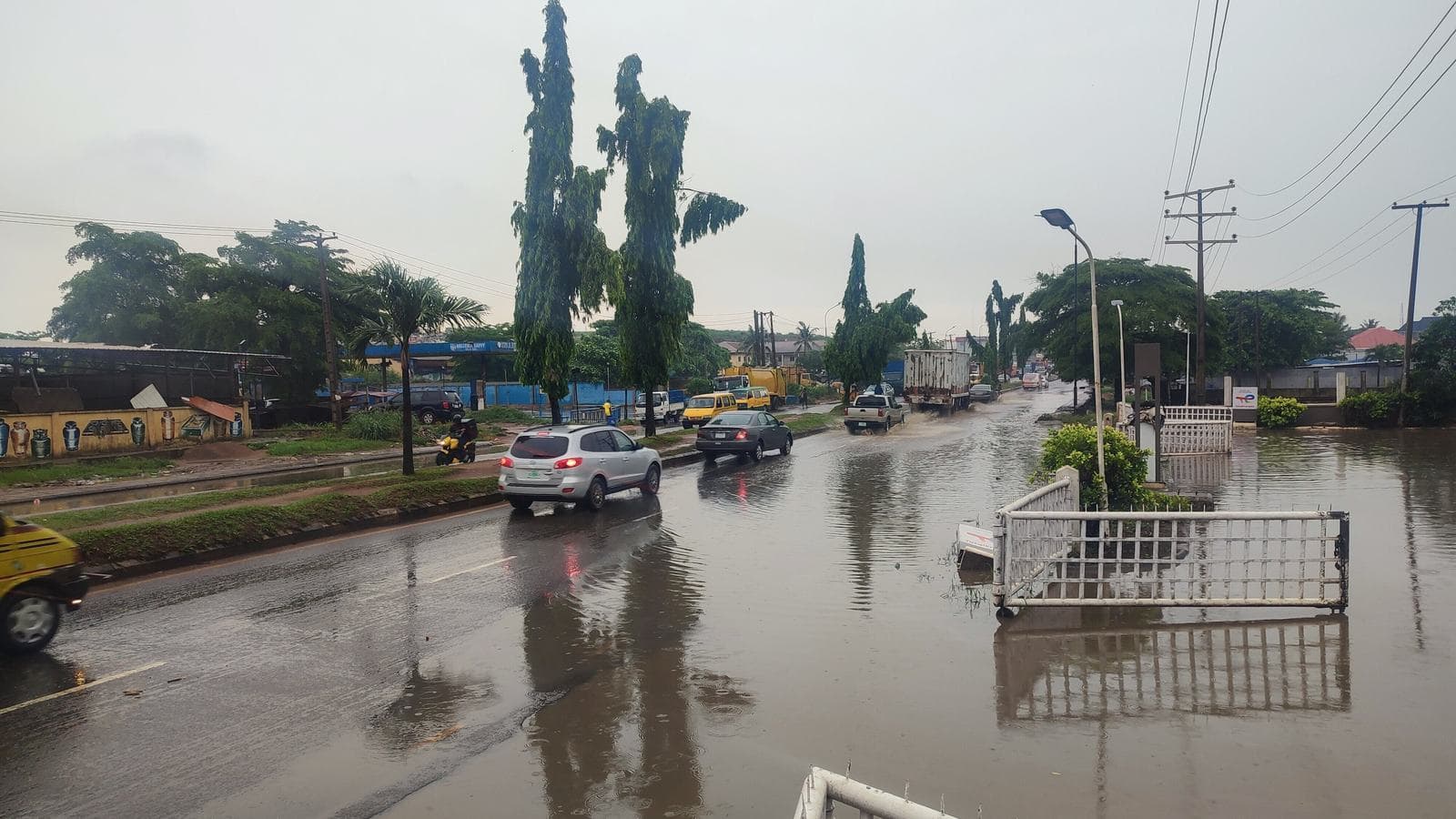
Most flood decisions in Ajah are made in a five-minute window: whether to leave now, wait, or change the route. The useful information is not "it rained last night" but which stretch is holding water, how deep it is, and whether traffic is moving through it.
For school runs, earlier is usually safer. Peak traffic around Ajah junction and the expressway builds quickly, and a delay at one flooded stretch can push the whole trip into the worst of the morning. If a route is already reported as impassable, do not treat a different app's estimated travel time as proof that it has cleared.
Avoid driving or wading through moving water. Depth is hard to judge from a vehicle, and a road that looks shallow can hide an open drain or a collapsed edge. If you cannot see the road surface, turn around. This is general safety guidance, not a substitute for instructions from emergency agencies.
Keep one rule for the household: nobody crosses a flooded stretch alone, and nobody guesses. A short wait or a longer route is cheaper than a recovery operation.
How to verify a flood update before you share it
Flood messages spread faster than water. The most common failure is not a malicious rumour; it is an old photograph forwarded without a date. Lagos flood images recirculate every rainy season, and a dramatic picture from another year can send hundreds of people into the same jam.
Before you act on a post, look for three things. First, a time: "now", "20 minutes ago" or a timestamp, not "this morning" on a message that may be days old. Second, a landmark you can place: the Ajah underbridge, a named estate gate, a specific junction. Third, a second confirmation from someone else on the same stretch, or an official advisory that matches it.
Be equally careful with the opposite mistake: assuming that because your street is dry, the next one is fine. Flooding in Ajah is patchy. A resident two streets away may be looking at a completely different road.
If you post an update, write it the way you would want to receive it: location, time, what you can actually see, and whether you have reported it. Avoid naming individuals, guessing the cause, or repeating casualty claims you cannot verify.
After the water recedes: what residents can do
Once a flood passes, the useful work starts. Photograph the high-water mark and any damage before cleanup. Note the date and the location. If the same drain blocks every season, repeated records are more useful to a residents' association or estate management than a single complaint.
Report drainage problems through the channel that owns them: estate management for internal roads, the local government or the Lagos State Ministry of Environment and Water Resources for public drains. For emergencies involving danger to life or property, LASEMA lists 767 and 112 as its toll-free lines.
Check on neighbours who may have less capacity to move quickly: older residents, people with disabilities, and households with young children. Coordination is the part of flood response that residents can genuinely own. Rescue and enforcement are not.
This guide is general information. It is not medical, legal or emergency advice, and it does not replace instructions from LASEMA, NiHSA or the Lagos State Government.
Where Watchdoor fits in an Ajah rainy season
Watchdoor is a neighbourhood app, not an emergency service. Ajah residents use it to post street-level updates, ask neighbours what a route looks like, and keep a local record of recurring problems. The Ajah area page collects the context that a citywide forecast cannot: which junction is holding water, which school run is delayed, and which estate gate is affected.
The value is in the verification habit, not the volume of alerts. A short post with a landmark and a time is more useful than a dramatic video with no location. A neighbour confirming the same stretch turns a single observation into something the next household can act on.
Watchdoor does not dispatch responders, does not replace the police or LASEMA, and is not affiliated with any government agency. For a real emergency, call 767 or 112. For everything else, the neighbourhood feed is where residents can compare notes before they leave home.
Sources used for this article
Quick answers
Is Ajah flooded today?
No article can tell you whether a specific street is flooded right now. The Lagos State Government issues alerts through official channels, and conditions change within hours. Check the Lagos State Ministry of Environment and Water Resources and the Nigeria Hydrological Services Agency for current advisories, then confirm the state of your own route with residents who are actually there.
Which Ajah communities did Lagos State name in its flood alert?
The Lagos State Government's September 2026 advisory named Eti-Osa, Lagos Island, Oke-Ira Nla in Ajah, Kirikiri Sea Port, Ilaje Waterfront Jetty and Jetty Terminal B among the vulnerable locations. Oke-Ira Nla was the Ajah-area community specifically listed.
Who should I call during a flood emergency in Lagos?
Call the Lagos State emergency lines 767 or 112, which LASEMA lists as its toll-free emergency numbers. Use them for emergencies involving danger to life or property, not for routine traffic questions. Watchdoor is not an emergency service and does not dispatch responders.
How can I tell a current flood update from an old photograph?
Look for a time, a recognisable landmark and a second independent confirmation. A screenshot with no date, a photo that could have been taken in any rainy season, or a message that asks you to forward it urgently is not verification. Old flood photos recirculate every year, so ask when and where the image was taken before you act on it.
Does Watchdoor report floods to LASEMA?
No. Watchdoor is a neighbourhood app where residents share local information. It is not affiliated with LASEMA, NiHSA, the Lagos State Government or any emergency agency, and it does not dispatch rescue teams. For emergencies, contact the official lines directly.
More from the Watchdoor blog
Keep exploring Watchdoor
Use the feature overview to understand the full platform, or visit the business page to see how local growth tools fit into the broader neighborhood product.